One80 leverages open source mapping technology, reports, and other forms of information to map hazards in real time. These hazard maps allow carrier & broker partners to identify clients in need of communication or resources to minimize the impacts of a catastrophe or potential catastrophe. Our current maps are shown below.
In addition to our hazard mappings each map is accompanied by a dashboard. These dashboards contain historic data specific to each peril or perils being mapped and can be a useful tool to gain insights into each peril.
CAT Mapping Views
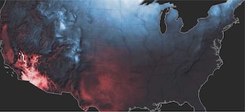
CAT Model
Mapping of current National Weather Service (NWS) warnings & hazards, as well as the latest Quantitative Precipitation Forecasts (QPFs)
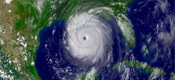
Atlantic Storms
Mapping of current National Hurricane Center (NHC) data on Atlantic basin storms. Including predictive modelling and storm surge
Wildfire
Mapping of current Fire Information for Resource Management System (FIRMS) data, using Moderate Resolution Imaging Spectroradiometer (MODIS) active fire detection
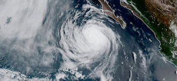
Pacific
Mapping of current National Hurricane Center (NHC) data on Eastern Pacific basin storms. Including predictive modelling and storm surge
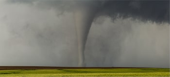
Tornado
Mapping of recent NOAA’s National Weather Service (NWS) Storm Prediction Center reported tornado, tornado force winds, and hail occurrences

Earthquake
Mapping of recent USGS Earthquake Hazards Program of the U.S. Geological Survey (USGS) recently reported earthquakes
Severe Weather & CAT Issues
Severe weather is any dangerous meteorological phenomenon with the potential to cause damage, serious social disruption, or loss of human life. Types of severe weather phenomena vary, depending on the latitude, altitude, topography, and atmospheric conditions. High winds, hail, excessive precipitation, and wildfires are forms and effects of severe weather, as are thunderstorms, downbursts, tornadoes, waterspouts, tropical cyclones, and extratropical cyclones. Regional and seasonal severe weather phenomena include blizzards (snowstorms), ice storms, and duststorms. Extreme weather phenomena which cause extreme heat, cold, wetness or drought often will bring severe weather events.
NWS Warnings & Hazards
Data is pulled from the National Weather Service (NWS). That data is summarized here:
The National Weather Service (NWS) is an organization that relies heavily on science, partnerships, and ties to local communities to successfully provide weather, water, and climate data, forecasts and warnings for the protection of life and property and the enhancement of the national economy. The NWS works with many partners, including those from national and local government, members of the weather enterprise, Weather-Ready Nation Ambassadors, and Academia to help educate people in all communities on how to stay safe and ensure important weather information, such as warnings, reach the broadest possible audience.
Quantitative Precipitation Forecasts
Data is pulled from the Weather Prediction Center (WPC).
The beginnings of WPC can be traced back to 1942 with the establishment of the Weather Bureau Analysis Center in an effort to coordinate with civil meteorological facilities and services for World War II purposes. In 1958, the center became part of the National Meteorological Center (NMC). The center underwent several name changes and reorganizations, eventually becoming the Hydrometeorological Prediction Center (HPC) in 1995 and the Weather Predication Center (WPC) in 2013. Our center is continually evolving to serve our customers in the most efficient and effective manner. WPC is a center of excellence in the prediction of high-impact precipitation events. Our forecast domain covers the entire continental United States (CONUS) as well as Alaska and Hawaii.
Preparing for Severe Weather
Severe weather can happen anytime, in any part of the country. Severe weather can include hazardous conditions produced by thunderstorms, including damaging winds, tornadoes, large hail, flooding and flash flooding, and winter storms associated with freezing rain, sleet, snow and strong winds.
During A Severe Storm
- When thunder roars, go indoors! Move from outdoors into a building or car with a roof.
- Pay attention to alerts and warnings.
- Avoid using electronic devices connected to an electrical outlet.
- Avoid running water.
- Turn Around. Don’t Drown! Do not drive through flooded roadways. Just six inches of fast-moving water can knock you down, and one foot of moving water can sweep your vehicle away.
During A Flood
- Evacuate immediately, if told to evacuate. Never drive around barricades. Local responders use them to safely direct traffic out of flooded areas.
- Contact your healthcare provider If you are sick and need medical attention. Wait for further care instructions and shelter in place, if possible. If you are experiencing a medical emergency, call 9-1-1.
- Listen to EAS, NOAA Weather Radio or local alerting systems for current emergency information and instructions regarding flooding.
- Do not walk, swim or drive through flood waters. Turn Around. Don’t Drown!
- Stay off bridges over fast-moving water. Fast-moving water can wash bridges away without warning.
- Stay inside your car if it is trapped in rapidly moving water. Get on the roof if water is rising inside the car.
- Get to the highest level if trapped in a building. Only get on the roof if necessary and once there signal for help. Do not climb into a closed attic to avoid getting trapped by rising floodwater.
During Winter Weather
- Stay off roads if at all possible. If trapped in your car, then stay inside.
- Limit your time outside. If you need to go outside, then wear layers of warm clothing. Watch for signs of frostbite and hypothermia.
- Reduce the risk of a heart attack by avoiding overexertion when shoveling snow and walking in the snow.

Ready.Gov is a National public service campaign designed to educate and empower the American people to prepare for, respond to and mitigate emergencies, including natural and man-made disasters. It is maintained by The Federal Emergency Management Agency (FEMA), a part of the U.S. Department of Homeland Security.
It is an excellent resource for information on emergency preparation and preparedness.
Tropical Storms
A tropical cyclone is a generic term for a low-pressure system that formed over tropical waters (25°S to 25°N) with thunderstorm activity near the center of its closed, cyclonic winds. Tropical cyclones derive their energy from vertical temperature differences, are symmetrical, and have a warm core.
If it lacks a closed circulation it is called a tropical disturbance. If it has a closed circulation but under 39 mph (34 knots, or 17 meters per second) maximum sustained surface winds, it is called a tropical depression. When winds exceed that threshold, it becomes a tropical storm and is given a name. Once winds exceed 74 mph (64 knots, 33 meters per second) it will be designated a hurricane (in the Atlantic or East Pacific Oceans) or a typhoon (in the northern West Pacific).
Tropical Disturbances -> Tropical Depressions -> Tropical Storms -> Hurricane.
Tropical Storm Tracks & Models
Data is pulled from the National Hurricane Center (NHC). That data is summarized here:
The National Hurricane Center (NHC) is a component of the National Centers for Environmental Prediction (NCEP) located at Florida International University in Miami, Florida. The NHC mission is to save lives, mitigate property loss, and improve economic efficiency by issuing the best watches, warnings, forecasts, and analyses of hazardous tropical weather and by increasing understanding of these hazards. The NHC vision is to be America’s calm, clear, and trusted voice in the eye of the storm and, with its partners, enable communities to be safe from tropical weather threats.
Quantitative Precipitation Forecasts
Data is pulled from the National Weather Service (NWS).
The National Weather Service (NWS) is an organization that relies heavily on science, partnerships, and ties to local communities to successfully provide weather, water, and climate data, forecasts and warnings for the protection of life and property and the enhancement of the national economy. The NWS works with many partners, including those from national and local government, members of the weather enterprise, Weather-Ready Nation Ambassadors, and Academia to help educate people in all communities on how to stay safe and ensure important weather information, such as warnings, reach the broadest possible audience.
NWS Offices provide forecast information in a way that better supports how emergency managers, first responders, government officials, businesses, and the public are able to make fast, smart decisions to save lives, property, and enhance livelihoods. This helps mitigate the devastating impacts of extreme events like record breaking snowfall, violent tornadoes, destructive hurricanes, widespread flooding, and devastating drought. We are able to do this through our professional expertise, securing new data, and investigating technologies that will improve forecasts and ultimately increase weather-readiness. While we at NOAA’s National Weather Service are taking steps towards building a Weather-Ready Nation, we cannot do it alone! Please read further to learn more about how we work with our partners to build a Weather-Ready Nation.
Preparing for Tropical Storms
Hurricanes are dangerous and can cause major damage from storm surge, wind damage, rip currents and flooding. They can happen along any U.S. coast or in any territory in the Atlantic or Pacific oceans. Storm surge historically is the leading cause of hurricane-related deaths in the United States. The Atlantic Hurricane Season falls between June 1st and November 30th.
During A Tropical Storm
- Pay attention to emergency information and alerts.
- If you live in a mandatory evacuation zone and local officials tell you to evacuate, do so immediately.
- Determine how best to protect yourself from high winds and flooding.
- Take refuge in a designated storm shelter or an interior room for high winds.
- Go to the highest level of the building if you are trapped by flooding. Do not climb into a closed attic. You may become trapped by rising flood water.
- Do not walk, swim or drive through flood waters. Turn Around. Don’t Drown! Just six inches of fast-moving water can knock you down, and one foot of moving water can sweep your vehicle away.

Ready.Gov is a National public service campaign designed to educate and empower the American people to prepare for, respond to and mitigate emergencies, including natural and man-made disasters. It is maintained by The Federal Emergency Management Agency (FEMA), a part of the U.S. Department of Homeland Security.
It is an excellent resource for information on emergency preparation and preparedness.
Earthquakes
An earthquake (also known as a quake, tremor or temblor) is the shaking of the surface of the Earth resulting from a sudden release of energy in the Earth’s lithosphere that creates seismic waves. Earthquakes can range in size, from those that are so weak that they cannot be felt, to those violent enough to propel objects and people into the air and wreak destruction across entire cities. The seismicity, or seismic activity, of an area is the frequency, type, and size of earthquakes experienced over a particular time period. The word tremor is also used for non-earthquake seismic rumbling. At the Earth’s surface, earthquakes manifest themselves by shaking and displacing or disrupting the ground. When the epicenter of a large earthquake is located offshore, the seabed may be displaced sufficiently to cause a tsunami. Earthquakes can also trigger landslides and, occasionally, volcanic activity.
Earthquake Data
Data is pulled from the USGS Earthquake Hazards Program of the U.S. Geological Survey (USGS).
USGS is part of the National Earthquake Hazards Reduction Program (NEHRP) led by the National Institute of Standards and Technology (NIST). The USGS role in NEHRP is to provide Earth sciences information and products for earthquake loss reduction.
Plate Boundaries Data
Data is pulled from the USGS Earthquake Hazards Program of the U.S. Geological Survey (USGS).
Data shows the outermost shell of the Earth, which consists of a mosaic of rigid “plates” that have been moving relative to one another for hundreds of millions of years.
Preparing for Earthquakes
An earthquake is a sudden, rapid shaking of the ground caused by the shifting of rocks deep underneath the earth’s surface. Earthquakes can cause fires, tsunamis, landslides or avalanches. While they can happen anywhere without warning, areas at higher risk for earthquakes include Alaska, California, Hawaii, Oregon, Puerto Rico, Washington and the entire Mississippi River Valley.
During An Earthquake
If an earthquake happens, protect yourself right away:
- If you are in a car, pull over and stop. Set your parking brake.
- If you are in bed, turn face down and cover your head and neck with a pillow.
- If you are outdoors, stay outdoors away from buildings.
- If you are inside, stay and do not run outside and avoid doorways.

Ready.Gov is a National public service campaign designed to educate and empower the American people to prepare for, respond to and mitigate emergencies, including natural and man-made disasters. It is maintained by The Federal Emergency Management Agency (FEMA), a part of the U.S. Department of Homeland Security.
It is an excellent resource for information on emergency preparation and preparedness.
Tropical Storms
A Pacific hurricane is a mature tropical cyclone that develops within the northeastern and central Pacific Ocean to the east of 180°W, north of the equator. For tropical cyclone warning purposes, the northern Pacific is divided into three regions: the eastern (North America to 140°W), central (140°W to 180°), and western (180° to 100°E), while the southern Pacific is divided into 2 sections, the Australian region (90E to 160°E) and the southern Pacific basin between 160°E and 120°W. Identical phenomena in the western north Pacific are called typhoons. This separation between the two basins has a practical convenience, however, as tropical cyclones rarely form in the central north Pacific due to high vertical wind shear, and few cross the dateline.
Tropical Disturbances -> Tropical Depressions -> Tropical Storms -> Hurricane.
Tropical Storm Tracks & Models
Data is pulled from the National Hurricane Center (NHC). That data is summarized here:
The National Hurricane Center (NHC) is a component of the National Centers for Environmental Prediction (NCEP) located at Florida International University in Miami, Florida. The NHC mission is to save lives, mitigate property loss, and improve economic efficiency by issuing the best watches, warnings, forecasts, and analyses of hazardous tropical weather and by increasing understanding of these hazards. The NHC vision is to be America’s calm, clear, and trusted voice in the eye of the storm and, with its partners, enable communities to be safe from tropical weather threats.
Storm Surge / Wave Heights
Data is pulled from the National Weather Service (NWS).
The National Weather Service (NWS) is an organization that relies heavily on science, partnerships, and ties to local communities to successfully provide weather, water, and climate data, forecasts and warnings for the protection of life and property and the enhancement of the national economy. The NWS works with many partners, including those from national and local government, members of the weather enterprise, Weather-Ready Nation Ambassadors, and Academia to help educate people in all communities on how to stay safe and ensure important weather information, such as warnings, reach the broadest possible audience.
NWS Offices provide forecast information in a way that better supports how emergency managers, first responders, government officials, businesses, and the public are able to make fast, smart decisions to save lives, property, and enhance livelihoods. This helps mitigate the devastating impacts of extreme events like record breaking snowfall, violent tornadoes, destructive hurricanes, widespread flooding, and devastating drought. We are able to do this through our professional expertise, securing new data, and investigating technologies that will improve forecasts and ultimately increase weather-readiness. While we at NOAA’s National Weather Service are taking steps towards building a Weather-Ready Nation, we cannot do it alone! Please read further to learn more about how we work with our partners to build a Weather-Ready Nation.
Preparing for Tropical Storms
Hurricanes are dangerous and can cause major damage from storm surge, wind damage, rip currents and flooding. They can happen along any U.S. coast or in any territory in the Atlantic or Pacific oceans. Storm surge historically is the leading cause of hurricane-related deaths in the United States. The Eastern Pacific Hurricane Season falls between May 15th and November 30th
During A Tropical Storm
- Pay attention to emergency information and alerts.
- If you live in a mandatory evacuation zone and local officials tell you to evacuate, do so immediately.
- Determine how best to protect yourself from high winds and flooding.
- Take refuge in a designated storm shelter or an interior room for high winds.
- Go to the highest level of the building if you are trapped by flooding. Do not climb into a closed attic. You may become trapped by rising flood water.
- Do not walk, swim or drive through flood waters. Turn Around. Don’t Drown! Just six inches of fast-moving water can knock you down, and one foot of moving water can sweep your vehicle away.

Ready.Gov is a National public service campaign designed to educate and empower the American people to prepare for, respond to and mitigate emergencies, including natural and man-made disasters. It is maintained by The Federal Emergency Management Agency (FEMA), a part of the U.S. Department of Homeland Security.
It is an excellent resource for information on emergency preparation and preparedness.
Tornadoes
A tornado is a violently rotating column of air that is in contact with both the surface of the Earth and a cumulonimbus cloud or, in rare cases, the base of a cumulus cloud. It is often referred to as a twister, whirlwind or cyclone, although the word cyclone is used in meteorology to name a weather system with a low-pressure area in the center around which, from an observer looking down toward the surface of the earth, winds blow counterclockwise in the Northern Hemisphere and clockwise in the Southern. Tornadoes come in many shapes and sizes, and they are often visible in the form of a condensation funnel originating from the base of a cumulonimbus cloud, with a cloud of rotating debris and dust beneath it. Most tornadoes have wind speeds less than 110 miles per hour (180 km/h), are about 250 feet (80 m) across, and travel a few miles (several kilometers) before dissipating. The most extreme tornadoes can attain wind speeds of more than 300 miles per hour (480 km/h), are more than two miles (3 km) in diameter, and stay on the ground for dozens of miles (more than 100 km).
Tornado Data
Data is pulled from the National Weather Service (NWS) Storm Prediction Center.
The Storm Prediction Center (SPC) is part of the National Weather Service (NWS) and the National Centers for Environmental Prediction (NCEP). Their mission is to provide timely and accurate forecasts and watches for severe thunderstorms and tornadoes over the contiguous United States. The SPC also monitors hazardous winter weather and fire weather events across the U.S. and issues specific products for those hazards. They use the most advanced technology and scientific methods available to achieve this goal.
Tornado Watches
Data is pulled from the National Weather Service (NWS). That data is summarized here:
The National Weather Service (NWS) is an organization that relies heavily on science, partnerships, and ties to local communities to successfully provide weather, water, and climate data, forecasts and warnings for the protection of life and property and the enhancement of the national economy. The NWS works with many partners, including those from national and local government, members of the weather enterprise, Weather-Ready Nation Ambassadors, and Academia to help educate people in all communities on how to stay safe and ensure important weather information, such as warnings, reach the broadest possible audience.
Preparing for Tornados
Tornadoes are violently rotating columns of air that extend from a thunderstorm to the ground. Tornadoes can destroy buildings, flip cars, and create deadly flying debris.
During A Tornado
- Immediately go to a safe location that you have identified.
- Pay attention to EAS, NOAA Weather Radio, or local alerting systems for current emergency information and instructions.
- Protect yourself by covering your head or neck with your arms and putting materials such as furniture and blankets around or on top of you.
- Do not try to outrun a tornado in a vehicle if you are in a car. If you are in a car or outdoors and cannot get to a building, cover your head and neck with your arms and cover your body with a coat or blanket, if possible.

Ready.Gov is a National public service campaign designed to educate and empower the American people to prepare for, respond to and mitigate emergencies, including natural and man-made disasters. It is maintained by The Federal Emergency Management Agency (FEMA), a part of the U.S. Department of Homeland Security.
It is an excellent resource for information on emergency preparation and preparedness.
Wildfire
A wildfire is an uncontrolled fire that burns in the wildland vegetation, often in rural areas. Wildfires can burn in forests, grasslands, savannas, and other ecosystems, and have been doing so for hundreds of millions of years. They are not limited to a particular continent or environment. Wildfires can burn in vegetation located both in and above the soil. Ground fires typically ignite in soil thick with organic matter that can feed the flames, like plant roots. Ground fires can smolder for a long time—even an entire season—until conditions are right for them to grow to a surface or crown fire. Surface fires, on the other hand, burn in dead or dry vegetation that is lying or growing just above the ground. Parched grass or fallen leaves often fuel surface fires. Crown fires burn in the leaves and canopies of trees and shrubs.
Wildfire Data
Data is pulled from the FIRMS US/Canada datasets, specifically the NASA MODIS Satellite. That data is summarized here:
Near real-time (NRT) Moderate Resolution Imaging Spectroradiometer (MODIS) Thermal Anomalies / Fire locations – Collection 6 processed by NASA’s Land, Atmosphere Near real-time Capability for EOS (LANCE) Fire Information for Resource Management System (FIRMS), using swath products (MOD14/MYD14) rather than the tiled MOD14A1 and MYD14A1 products. The thermal anomalies / active fire represent the center of a 1km pixel that is flagged by the MODIS MOD14/MYD14 Fire and Thermal Anomalies algorithm (Giglio 2003) as containing one or more fires within the pixel. This is the most basic fire product in which active fires and other thermal anomalies, such as volcanoes, are identified
Drought
Data is pulled from the US Drought Monitor site.
The Drought Monitor has been a team effort since its inception in 1999, produced jointly by the National Drought Mitigation Center (NDMC) at the University of Nebraska-Lincoln, the National Oceanic and Atmospheric Administration (NOAA), and the U.S. Department of Agriculture (USDA). The NDMC hosts the web site of the drought monitor and the associated data, and provides the map and data to NOAA, USDA and other agencies. It is freely available at droughtmonitor.unl.edu.
The U.S. Drought Monitor is jointly produced by the National Drought Mitigation Center at the University of Nebraska-Lincoln, the United States Department of Agriculture, and the National Oceanic and Atmospheric Administration. Map courtesy of NDMC.
Preparing for Wildfires
Wildfires are unplanned fires that burn in natural areas like forests, grasslands or prairies. These dangerous fires spread quickly and can devastate not only wildlife and natural areas, but also communities.
During A Wildfire
- Pay attention to emergency alerts and notifications for information and instructions.
- Evacuate immediately if authorities tell you to do so!
- If trapped, call 9-1-1 and give your location, but be aware that emergency response could be delayed or impossible. Turn on lights to help rescuers find you.
- Use an N95 mask to protect yourself from smoke inhalation or limit your exposure to smoke:
- If you are sick and need medical attention, contact your healthcare provider for further care instructions and shelter in place, if possible.

Ready.Gov is a National public service campaign designed to educate and empower the American people to prepare for, respond to and mitigate emergencies, including natural and man-made disasters. It is maintained by The Federal Emergency Management Agency (FEMA), a part of the U.S. Department of Homeland Security.
It is an excellent resource for information on emergency preparation and preparedness.